India and NASA Join Forces: NISAR Satellite Mission Set to Transform Climate Monitoring From Space
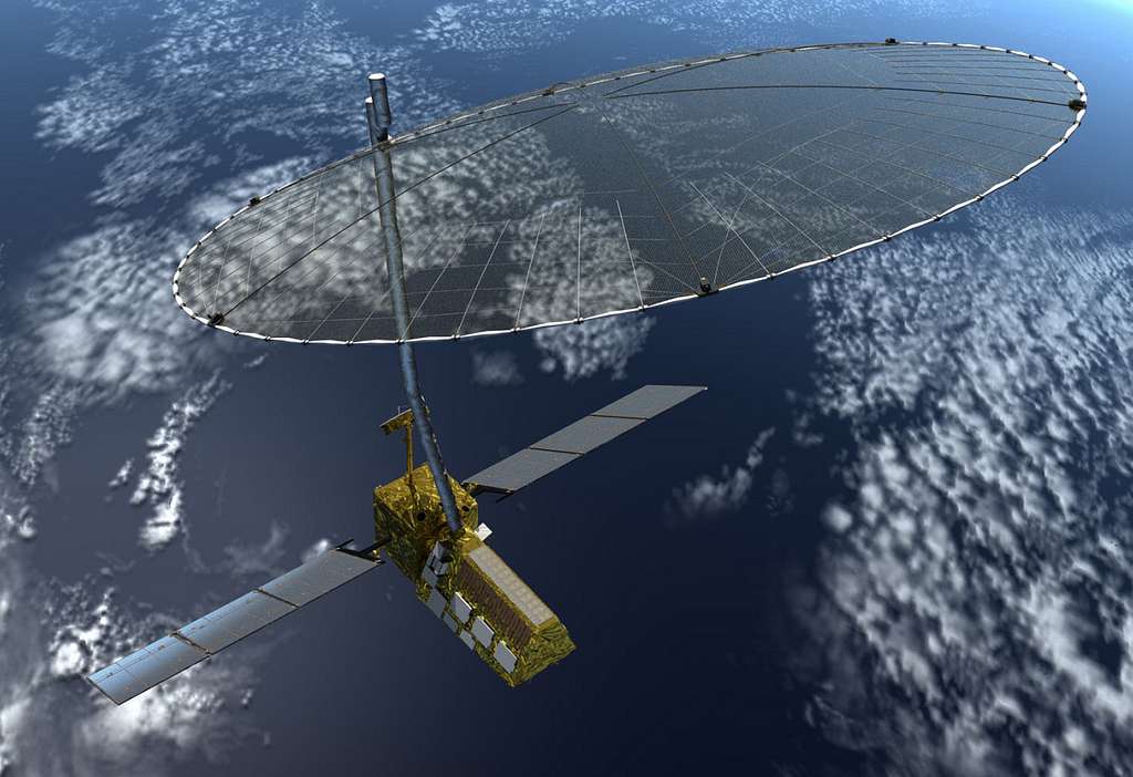
A groundbreaking collaboration between India's space agency ISRO and NASA is preparing to revolutionize how we monitor Earth's changing climate. The NASA-ISRO Synthetic Aperture Radar (NISAR) satellite, scheduled for launch in 2024, represents one of the most ambitious Earth observation missions ever attempted, promising unprecedented insights into climate threats facing our planet.
A Partnership Born from Shared Climate Concerns
The NISAR mission stands as a testament to international cooperation in addressing global climate challenges. This $1.5 billion joint venture combines NASA's L-band radar technology with ISRO's S-band radar system, creating a powerful dual-frequency observation platform that will scan nearly the entire Earth's surface every 12 days.
The satellite's sophisticated radar systems can penetrate cloud cover and operate day and night, providing continuous monitoring capabilities that optical satellites simply cannot match. This technological advancement addresses a critical gap in current climate monitoring infrastructure, particularly for tracking rapid environmental changes in remote or frequently cloud-covered regions.
Tracking Earth's Pulse: What NISAR Will Monitor
Ecosystem Changes and Carbon Dynamics
NISAR's primary mission focuses on monitoring biomass changes in forests and ecosystems worldwide. The satellite will track deforestation rates, forest degradation, and vegetation recovery patterns with unprecedented precision. These measurements are crucial for understanding carbon sequestration patterns and validating global carbon budget calculations.
The mission will provide detailed data on how forests respond to climate pressures, including droughts, wildfires, and temperature fluctuations. This information is essential for countries working to meet their carbon reduction commitments under international climate agreements.
Ice Sheet and Glacier Monitoring
One of NISAR's most critical functions involves monitoring ice dynamics in polar regions and mountain glaciers. The satellite will track ice sheet thickness changes, glacier flow rates, and seasonal ice variations with millimeter-level precision. This data is vital for improving sea-level rise projections and understanding how rapidly changing ice conditions affect global weather patterns.
Scientists estimate that NISAR's ice monitoring capabilities could reduce uncertainties in sea-level rise predictions by up to 30%, providing crucial information for coastal communities and infrastructure planning.
Natural Disaster Response
The satellite's rapid revisit capability makes it an invaluable tool for disaster response and risk assessment. NISAR will monitor ground deformation that precedes earthquakes, track volcanic activity, and assess flood patterns during extreme weather events. The satellite's ability to detect surface changes as small as a few centimeters could provide early warning signals for various natural disasters.
India's Growing Space Leadership
This mission reinforces India's position as a major player in global space technology and climate science. ISRO's contribution extends beyond hardware, with Indian scientists leading several aspects of data processing and analysis. The collaboration builds on India's successful track record in cost-effective space missions, including the Mars Orbiter Mission and Chandrayaan lunar program.
The partnership also strengthens India's capabilities in Earth observation technology, supporting the country's own climate monitoring needs as it faces increasing environmental challenges including extreme weather events, water scarcity, and agricultural pressures.
Global Impact and Scientific Applications
NISAR data will support multiple international climate initiatives, including the Global Stocktake under the Paris Climate Agreement and the UN Sustainable Development Goals. The mission's open data policy ensures that scientists worldwide can access information for research and policy development.
The satellite's measurements will directly contribute to climate models used by the Intergovernmental Panel on Climate Change (IPCC), potentially improving the accuracy of future climate projections. Agricultural agencies will use vegetation monitoring data to assess crop conditions and food security risks, while environmental organizations will leverage forest monitoring capabilities to combat illegal logging and habitat destruction.
Looking Ahead: A New Era of Climate Intelligence
The NISAR mission represents more than just technological achievement—it embodies a collaborative approach to addressing humanity's greatest environmental challenges. As climate impacts accelerate globally, the satellite's comprehensive monitoring capabilities will provide the detailed, timely information needed for effective climate adaptation and mitigation strategies.
When NISAR begins operations, it will join a constellation of Earth observation satellites, but its unique dual-radar system and rapid coverage capabilities will make it an indispensable tool for climate scientists, policymakers, and communities worldwide. The mission underscores how international cooperation and advanced technology can work together to better understand and protect our changing planet.
